Trolltunga road

Saturday 30 October is the last open day at P3.
After this year's season, we will asphalt and mark the parking lot. In the period 2-5 October, there will be some heavy traffic on the road due to this.
The Trolltunga road is a single track, private road up the steep Maagelia hillside. It does not take you to the Trolltunga site, only up the first 400 meters ascent. From the parking area on top there is a 4 hour hike in each direction.
The road was built to be used by locals, but has a capacity for a limited number of cars extra per day.(30)
IF YOU ARRIVE LONG TIME BEFORE OPENING HOURS, PLEASE TURN OFF THE ENGINE IN RESPECT OF NEIGHBORHOOD.
It is a single lane road with 17 hairpin bends and a maximum inclination of 17%.
Vehicles that are not suiteable for the drive will be denied access to the road by attendants on site.
The road opens at about 08.00 AM each morning, and a limited number of vehicles are premitted to drive up to the parking area. When the capacity is filled the road will close for the day, so it's a good idea to arrive early.
The gate is serviced by traffic attendants, and each driver will be brifed on how to drive a steep road, and where and how to park.
-
VIDEO SURVEILLANCE
The gate area, parking lot and stream intakes are video surveillanced. The gate and parking area is surveillanced to prevent and/or document any incidents that may be of interest and clarification to either customers, suppliers of services or the company itself.
The stream intakes are surveillanced to observe the water flow, and make it possible to take action if water flow exceeds the capacity of drainage pipes.
-

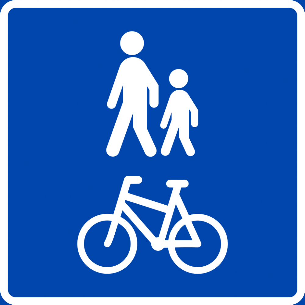
Hikers and bikes are welcome
The road is free to use for pedestrians and pedal bikes. It is an alternative to the hiking path that leads up the hill. Not as picturesque, but easier to walk if your legs are tired, and you don't have stop/step aside to make way for oncoming hikers on the path.
.
-
Restricted access
The road and parking area on top has a capacity for 30 vehicles each day.
- The road will close for the day when the limited parking area is filled.
- The exit gate will open automatically when approached by cars leaving the road.
- Parking fee: NOK 600,- per day. (The parking fee includes access to use the road)
- The gate area, parking lot and stream intakes are video surveillanced.
-
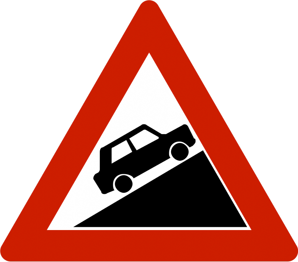
Steep track
The road has a 17% inclination at some points.
Vehicles that are not suiteable for the drive will be denied access to the road by attendants on site.
-
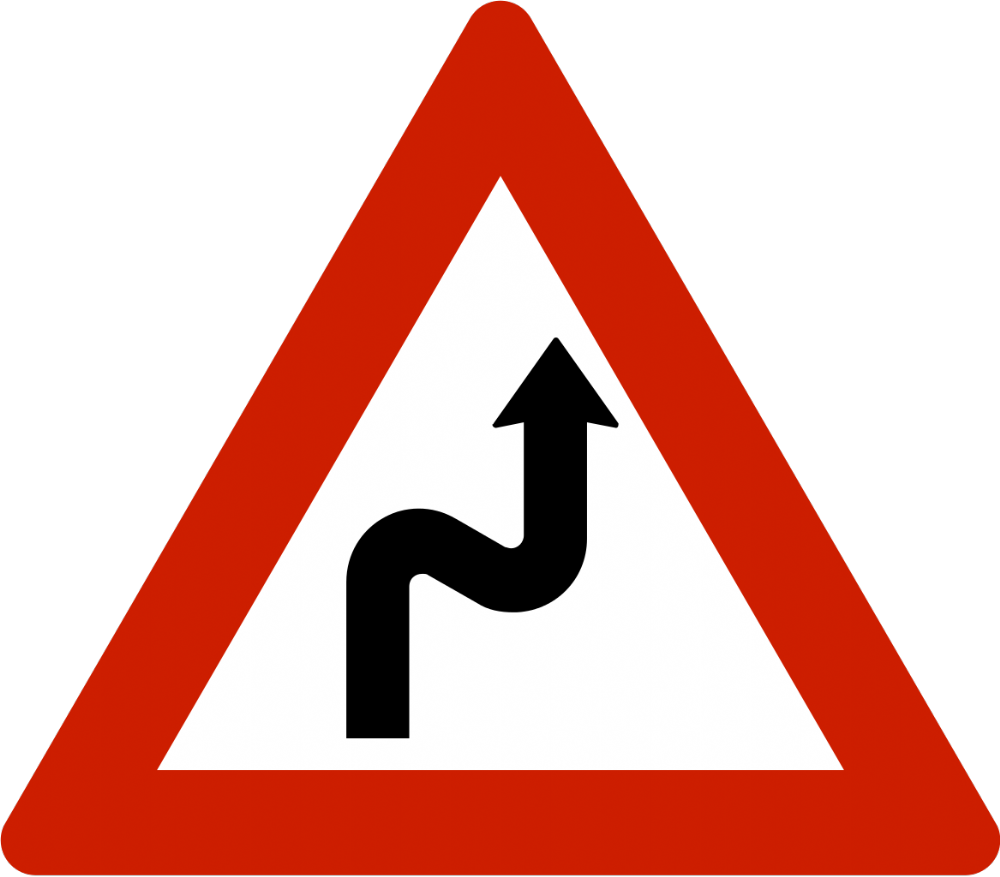
Hairpin bends
The road has 17 hairpin bends, which requires a skilled driver.
The road is narrow and the road sides are steep. Please evaluate your skills before embarking on the drive up. There is no place to turn the car around along the road, and backing a car down the road is very challenging.
-
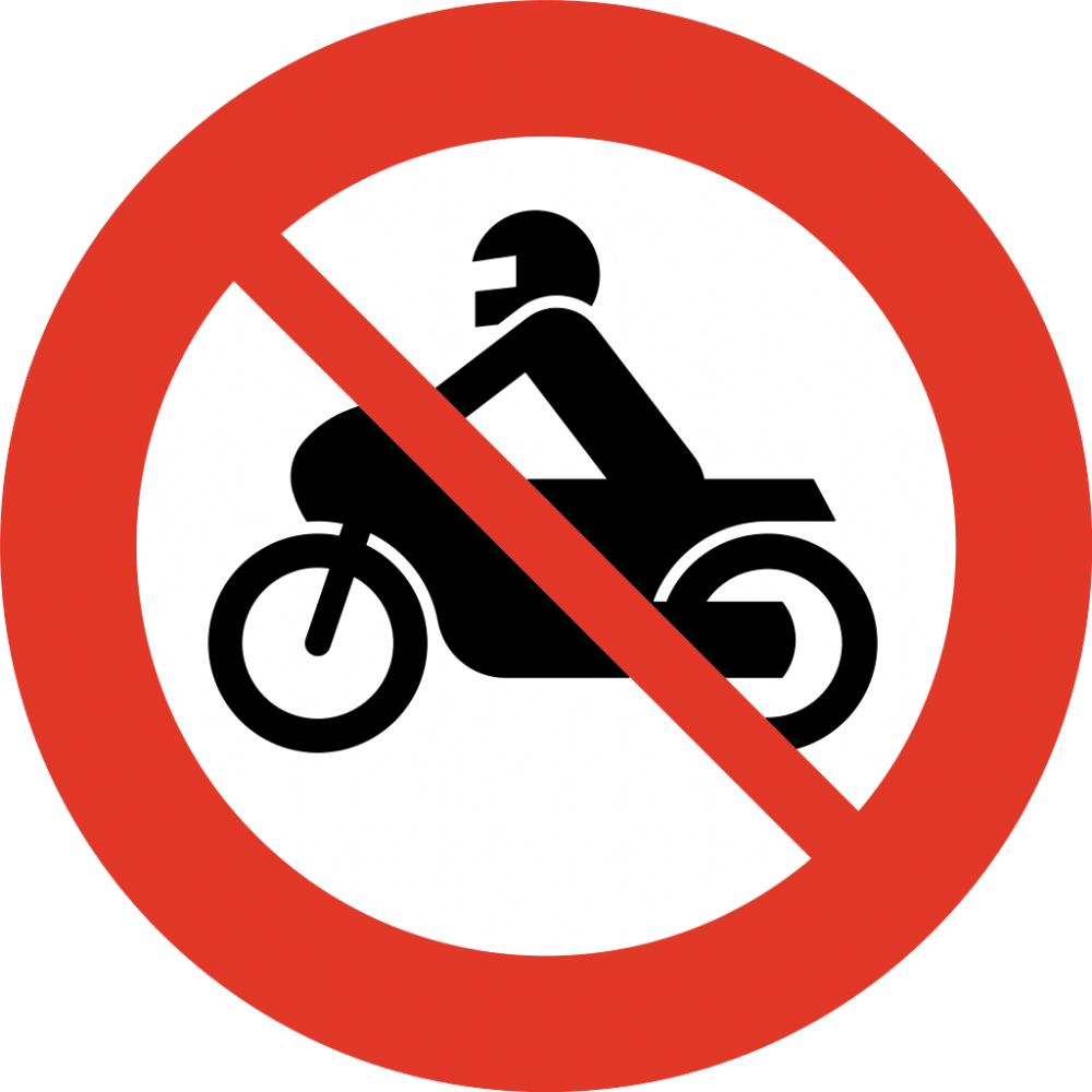
No motorcycles allowed
Due to the road's demanding conditions, no motorcycles are allowed on the road.
-
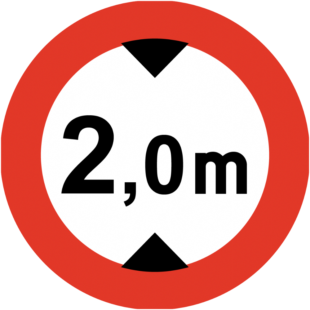
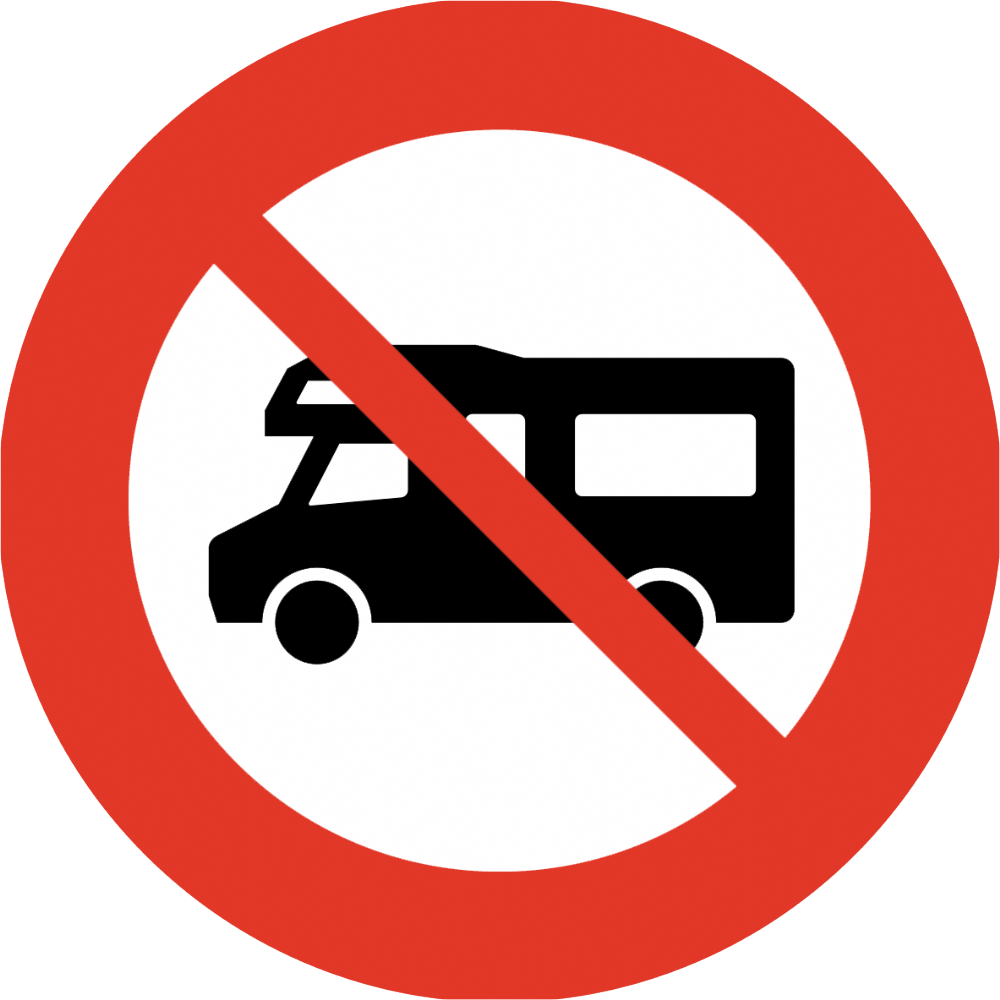
No camper vans above 2 meters height
Due to overhanging structures on the road there is a 2.0 meters maximum height for vehicles.
-
Parking only in designated area
Parking is only allowed in designated areas. Parking outside designated areas will block traffic and is strictly forbidden.
-
Bottom gate area.
Top parking area. Instructions for access and parking
See sketches for instructions
These sketches describe the gate area at the bottom of the hill and the parking area on top.
The bottom gate area is near the end of the public road in Skjeggedal. Signs will show the entrance and where to que up for the waiting line.
-
Photo credit, top banner: Destination Hardanger Fjord/ Till Hanten.